2009
2008
GPS-Info CMM - Display and use GPS coordinates embedded in photos directly in the Finder
GPS-Info CMM is a Contextual Menu Module designed for Mac OS X that displays the GPS coordinates of a photo file, and allows you to view that location in Google Earth, Flickr, Panoramio, Google Maps, or MapQuest.
2007
geobloggers » Flickr, KML, and a stroll down memory lane.
Flickr va très prochainement ajouter des liens vers des flux KML pour Google Earth en plus des liens RSS, mais c'est déjà utilisable, et ça déchire, comme on dit !
Most interesting geotagged flickr images - Google Maps
Les photos les plus intéressantes de Flickr positionnées sur les cartes Google Maps grâce à Yahoo!Pipes
geotagged - Nicolas Hoizey's Tagged Photos - Google Maps
Mes dernières photos sur Google Maps en 10 secondes grâces aux flux GeoRSS de Flickr !
geotagged - Nicolas Hoizey's Tagged Photos - Google Maps
Mes dernières photos sur Google Maps en 10 secondes grâces aux flux GeoRSS de Flickr !
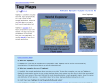
TagMaps
TagMaps is a toolkit to visualize text (well, tags) geographically on a map. Check out the sample applications, where we use Flickr tags on a map to build a world exploration tool.
1
(9 marks)
