2010
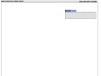
Live map of London Underground trains
"This map shows all trains (yellow pins) on the London Underground network in approximately real time"

Google Map Custom Marker Maker
by 2 others"To create your own custom marker, simply upload an image. A zip file containing the 6 separate images and some sample code (including the image map area coordinates) is created and made available for download."
Shawn Mayzes - Google Maps jQuery Plugin
by 2 others"The Google Maps jQuery Plugin lets you simply embed Google Maps using The Google Maps JavaScript API in your web pages."
2009
Zombie Outbreak Simulator
Impressionnante simulation d'attaque zombie s'appuyant sur Google Maps !

google-maps-icons - Project Hosting on Google Code
"Map icons collection is a pack of 600 free icons for your placemarks. You can put them manually in your Google Maps with the "My maps" feature, or automaticly with the Google Maps API. "

Zoom photo navigation in Google Maps Street View
Microsoft nous avait bluffé en 2007 avec ses photos de Notre-Dame de Paris présentées en 3D dans Photosynth (cherchez "Photosynth TED" dans Google), et voilà que Google propose une partie de ses principes dans Street View, génial !

Le métro parisien enfin dans Google Maps
Attention, ce n'est pour l'instant que le plan que l'on peut afficher, les itinéraires ne sont pas encore possibles, mais c'est déjà un grand bon en avant.
2008


Naviguez dans Google Maps en inclinant votre MacBook (Pro)
Après MacSaber, netPong ou SmackBook, voici une nouvelle application amusante (et utile, ce qui ne gache rien) exploitant le capteur de mouvement des portables Apple MacBook
GPS-Info CMM - Display and use GPS coordinates embedded in photos directly in the Finder
GPS-Info CMM is a Contextual Menu Module designed for Mac OS X that displays the GPS coordinates of a photo file, and allows you to view that location in Google Earth, Flickr, Panoramio, Google Maps, or MapQuest.
La Carte des sites sous SPIP • Balluche
Voici une carte qui représente les sites conçus avec le CMS SPIP.
2007
jQMaps by SeViR
by 1 otherjQMaps est un plugin jQuery permettant d'ajouter très facilement des cartes Google Maps avec différents points d'intérêt
Graphical gpslog fixer
This is a tool to correct those "way of" points. You can delete points or move them around.
1
(23 marks)
