2016
MapHub · Create interactive maps
Make a guide, embed maps on your website, organize your geo-data
2013
Countries - Open Data Index
The Open Data Index is an initiative of the Open Knowledge Foundation based on contributions from open data advocates and experts around the world.

OpenMeteoData - Libérons les données météorologiques.
OpenMeteoData est une association d'intérêt général à but non lucratif. Nous œuvrons pour libérer les données météorologiques, et les rendre accessibles à tout le monde.
2012

ratp.fr - Open Data
La RATP a choisi de s’associer à la démarche globale d’ouverture des données publiques (« Open Data »), initiée par l’Etat Français avec la mission Etalab et certaines collectivités et administrations, en rendant accessibles et utilisables par tous certaines de ses données.
2011
DataCouch | Collaborative Data
Turn spreadsheets into APIs and share them with anyone in the world.
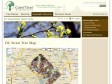
DC Street Tree Map › Interactive Maps & Tools › Geographic Resources | Casey Trees
These data were collected by UFA (Urban Forestry Administration) as they planted and maintained street trees in Washington DC. The tree data as well as LiDAR elevational information were downloaded from DCGIS OCTO and then joined together to produce this dataset. The street tree data were last updated in September 2010, and the LiDAR in 2009.


EUNIS - Welcome to EUNIS Database
EUNIS biodiversity database - find species, habitats and sites across Europe
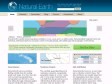
Natural Earth
Natural Earth is a public domain map dataset available at 1:10m, 1:50m, and 1:110 million scales. Featuring tightly integrated vector and raster data, with Natural Earth you can make a variety of visually pleasing, well-crafted maps with cartography or GIS software.

Open Data Challenge
European public bodies produce thousands upon thousands of datasets every year - about everything from how our tax money is spent to the quality of the air we breathe.
We are challenging designers, developers, journalists, researchers and others to people to come up with something useful, valuable or interesting for European citizens, built using open data.

1
(11 marks)
