March 2012

StateFace
A font you can use in your web apps when you want tiny state shapes as a design element.
It's designed to be used at small sizes, and the shapes have been highly simplified to make for a really small font. All 50 states plus D.C. and a wee continental U.S. map fit in about 22k, and they look great on Retina displays.
May 2011
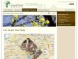
DC Street Tree Map › Interactive Maps & Tools › Geographic Resources | Casey Trees
These data were collected by UFA (Urban Forestry Administration) as they planted and maintained street trees in Washington DC. The tree data as well as LiDAR elevational information were downloaded from DCGIS OCTO and then joined together to produce this dataset. The street tree data were last updated in September 2010, and the LiDAR in 2009.
1
(2 marks)
